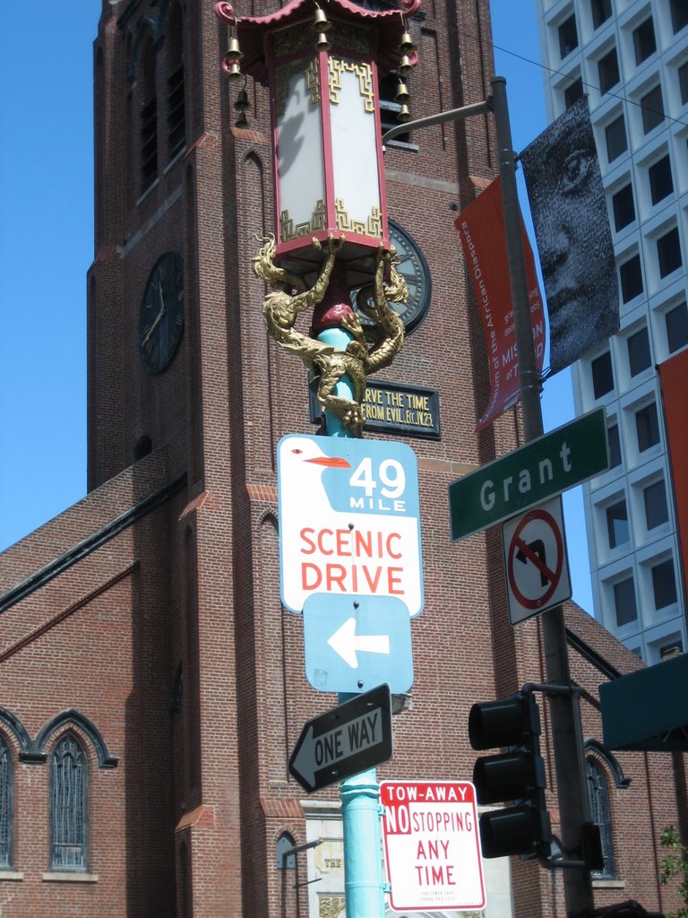
 Planned in 1938 to show of San Francisco, the 49-Mile Drive provides visitors with an overview of San Francisco's scenic attractions and historic highlights. The markers are easy to spot, marked by a blue and white seagull signs that lead you through the winding city route. I can assume that traffic wasn't such an issue as it is today and at one point included Coit Tower and the curvy part of Lombard Street.
The entire time I've lived here I've never driven the route and thought it would be a good thing to do on a lazy Saturday, especially since God gave us realy sunshine instead of the liquid sunshine we've been enjoying for the past week or so.
A quick Internet search provided a map (required) and we jumped in the car, rolled down the windows and headed to the starting point, City Hall. According to the information on the web, we were supposed to allow 4 to 5 hours to complete the journey. We assumed that it would not take us as long, since we were not going to make unnecessary stops (bathroom stops excluded). If you take the time to view the pictures, you'll note that 90% are taken from the car.
Driving in San Francisco can be a challenge and while the signs are fairly easy to follow, they don't always give you a lot of warning and the map came in handy for those unexpected detours which occured throughout the afternoon. Our first detour occured at City Hall where we encountered the anti-war demonstration to mark the third anniversary of the Iraq conflict. The Civic Center area is impressive but the route quickly skirted into the Tenderloin and the area now labled "Little Saigon." Sketchy is a good word to describe the area and one had to wonder what it looked like in 1938.
From there we drove through Cathedral Hill and made a short tour of Japan Town where the signs are posted in English and Japanese. The drive down to Union Square and China Town were easy to follow and then we headed up to Grace Cathedral and the second of our detours. My clutch was enjoying the hilly start and stop and we wondered whether there was a big truck convention because there seemed to more than a usual number of inappropriately sized vehicles on the road with bumper stickers like "Real Men Drive Fords" and "Bush/Cheney." We were supposed to drop down Clay to get to North Beach but a cop blocked the street and we had to figure out how to get back on track off of Powell St. when there are no left turns. This is where being a local came in handy. A couple of turns and we were back in traffic and stuck behind a tour bus.
We didn't move for ten minutes and a large woman in a VW bug chatted with us and crossed three lanes of traffic to head over a couple of streets. We followed, thinking that there must have been an accident. Nope. A funeral and apparently a large one that included a band, though Frank thinks the two groups were not connected. At this point the coffee from the morning was starting to say hello and I had options of pulling over and playing homeless on the street. Luckily, the cops cleared and we were back on track and heading up Grant street where with Doris Day parking stopped in front of the French Italian Bakery from a couple of bear claws and a bathroom break.
Surprisingly, the tour through North Beach was more of a skirt the edges of North Beach and did not include a drive by of Washington Square or the main drag. Oh well, we had Fisherman's Wharf to drive by and the Marina Green. This is where we picked up some time and really enjoyed the guided drive throuh the Presidio and a short stop at Baker beach.
From here we wandered past the Legion of Honor, the Cliff House and Lake Merced. The path through Golden Gate park did not seem as up to date and we created our own path and made it up to Twin Peaks. The interesting part of the drive is the trying to figure out why the choices to include certain streets were included and how people without a map could do it without a map. It was at this point that we realized that Frank pretty much lives on one part of the route and we could have started at his house and ended at his place.
Aside from Dolores Cathedral and Dolores Park the end of the Scenic Drive seemed a bit contrived. Originally, the drive included a trip on the Bay Bridge and a stop at Treasure Island. Now, you end up on the Embarcadero and wander through a bit more of downtown before working your way back to City Hall. At this point, we've spend a good four plus hours in the car and I was glad to see the garage door opening on California Street. It was a full day and we can say we've marked another tourist option off of our list of things to do.
Pictures: Click to View